
Da Caltagirone SP 194 a Gela SS 115 attraverso le strade di campagna
From Caltagirone (SP 194) to Gela (SS 115) via country roads

GREENET è la dizione breve di “GREENET – RETE DI GREENWAYS IN SICILIA, ovvero una Strategia per la riconnessione dei territori di eccellenza attraverso mobilità dolce intermodale” basata su strade secondarie, strade bianche e ferrovie dismesse. Si tratta di un progetto strategico votato all’unanimità dai Comuni UNESCO riuniti nel dicembre 2014 in seduta plenaria presso la Sala del Consiglio Comunale di Catania. Oltreché i siti UNESCO, GREENET si propone di interconnettere emergenze culturali di rilevante interesse presenti nel territorio regionale.
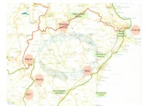
GREENET presenta un punto di snodo ad Agrigento, perché questa città così importante per la storia del mondo antico suddivide perfettamente la Sicilia in due parti. Caltagirone è una città UNESCO appartenente al sito seriale Città Tardo Barocche del Val di Noto e qualsiasi ipotesi del GREENET, ovvero di itinerari di mobilità dolce per i siti siciliani del World Heritage, deve poterla raggiungere.

Una possibile ipotesi di congiungente fra Agrigento e Caltagirone è stata di più sopralluoghi, fra i quali quello di venerdì 24 aprile. In particolare, si è inteso verificare la percorribilità del tratto di collegamento fra Caltagirone e Gela mediante le strade provinciali 194, Passo Cerasaro, 10, 35, 82. Di seguito il resoconto e, al termine, le valutazioni conclusive sul percorso.
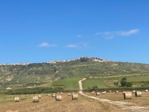
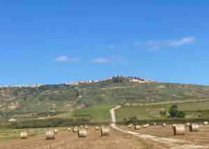
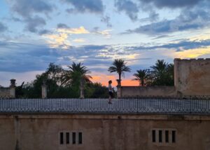
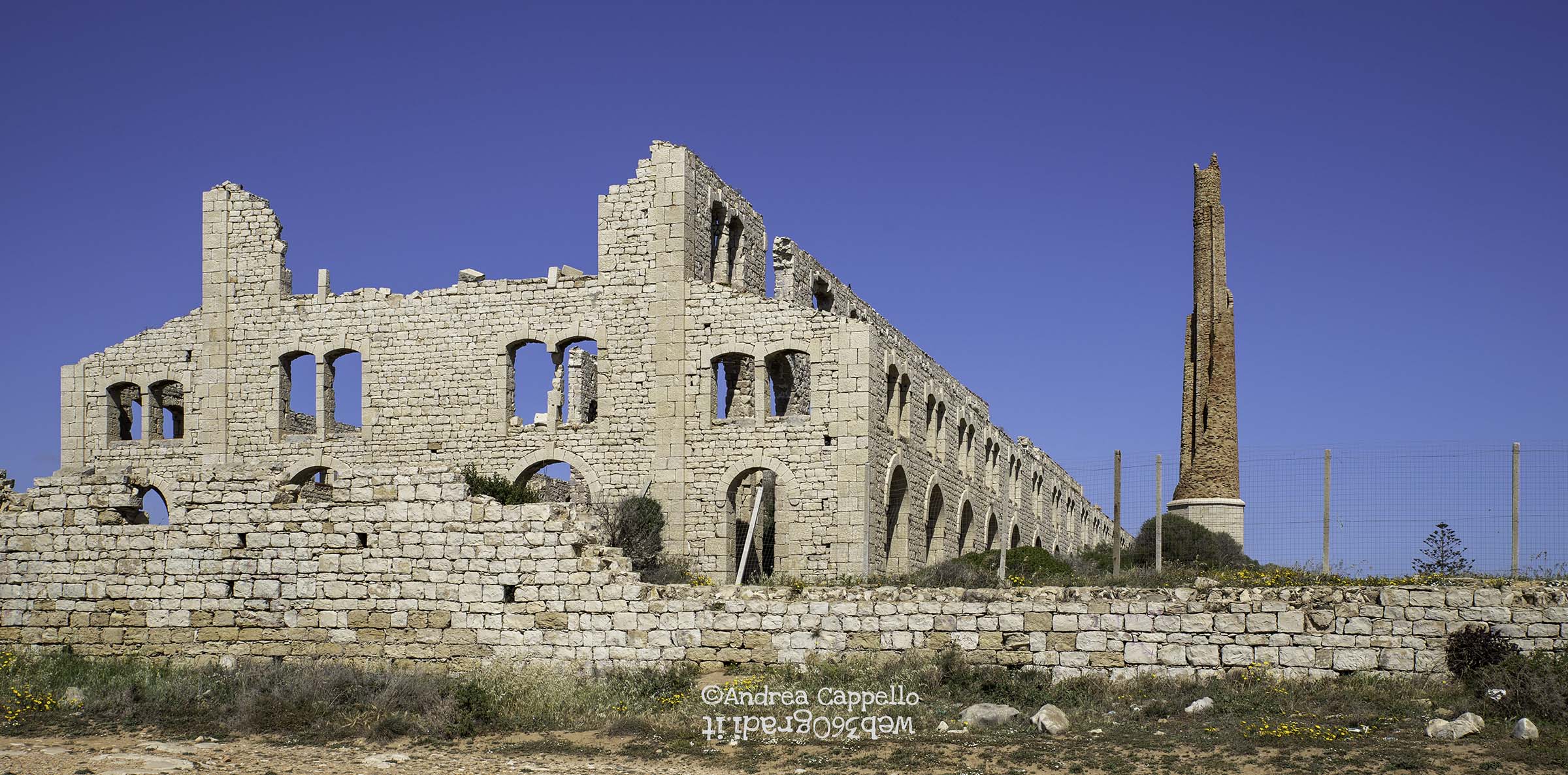
Il viaggio ha inizio da Caltagirone, dove in corrispondenza della Fornace Hoffmann, punto indicato sul navigatore, si imbocca la SP 194 verso il Santuario – o Convento – del Soccorso. Un percorso di 4,8 km in discesa stretta e tortuosa, ma perfettamente asfaltata, che in 4,8 km unisce le quote di 555 m slm fino a 255, con punte localmente maggiori della rispettabile pendenza media di 5,3%.

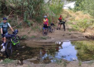
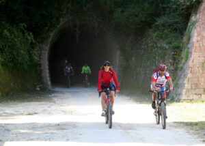
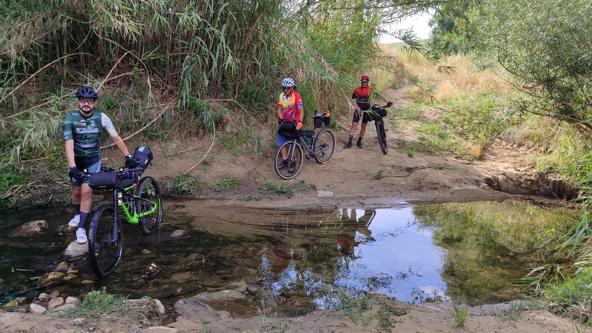
Azzeriamo il contachilometri e dal Santuario diamo inizio alla seconda parte, che terminerà al bivio che si incontra dopo 10 km. Durante il percorso si alternano tratti sterrati e asfaltati e si incontrano più punti di argille che, prevedibilmente, anche poche piogge renderanno intransitabili. Interessante la stazione della Rete meteorologica regionale che si incontra al km 4,6, con spiazzo (argilloso), fabbricati e passerella sul vallone; utile il lungo abbeveratoio al km 5,0, che a tutt’oggi presenta una minuscola canna d’acqua attiva, ancorché resa poco visibile dalla rigogliosa vegetazione che ricopre la vasca.

Al km 7 una grossa condotta metallica, visibilmente danneggiata e fuori uso, si affianca alla pista che stiamo percorrendo; al km 8,4 una massicciata pietrosa non dissipa i dubbi di impercorribilità in caso di piogge. Al km 9 si tralascia un bivio che a destra porta ad un caseggiato sopraelevato e, finalmente, al km 10, il bivio, che prendiamo a sinistra (est, visto il nostro viaggio è diretto verso sud).

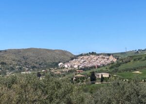
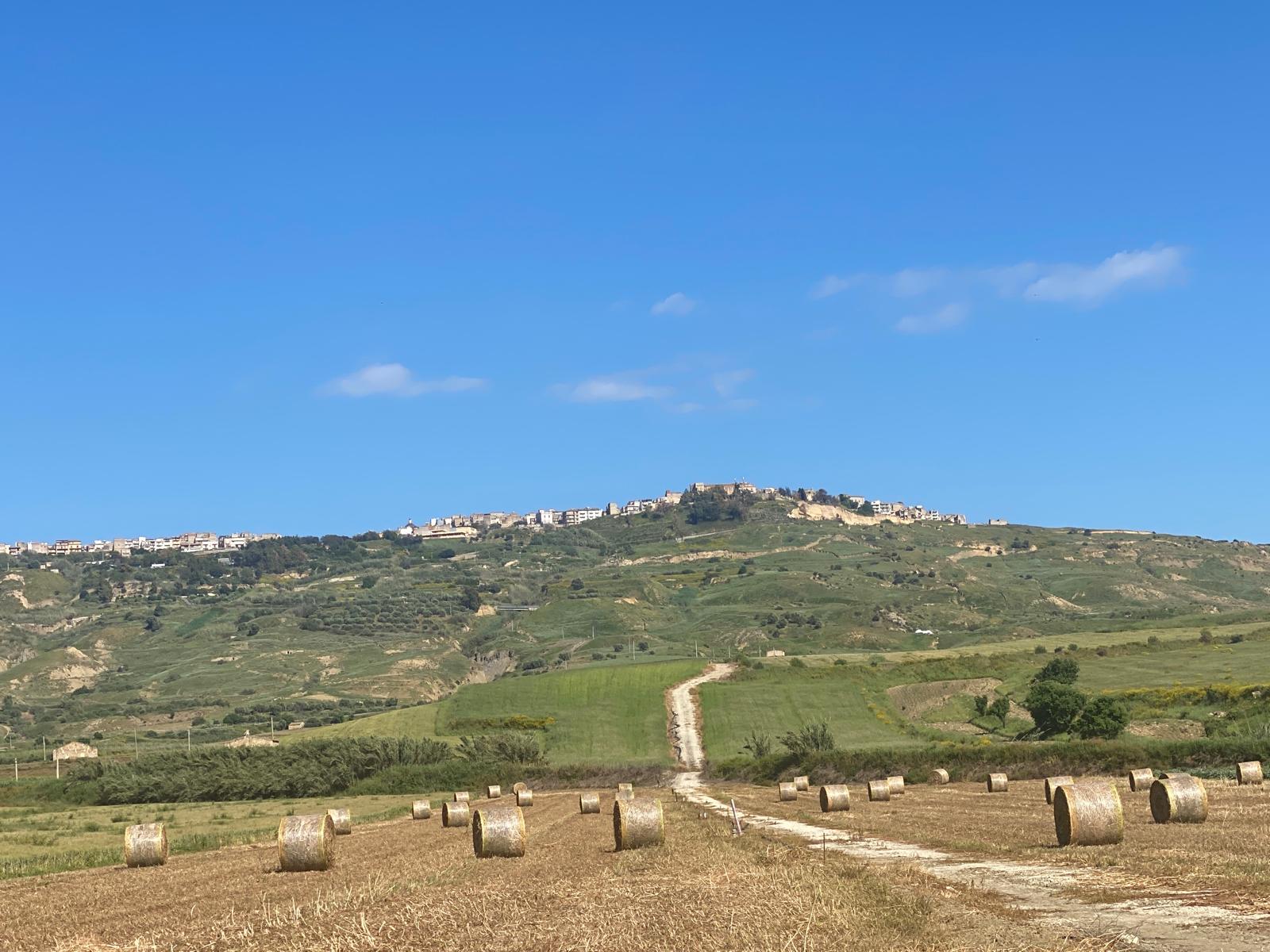
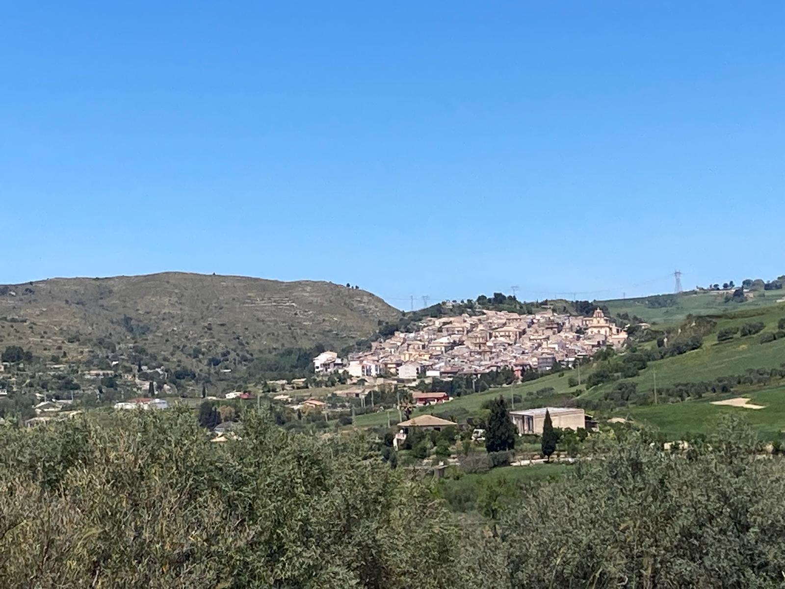
Ben visibile, sulla sinistra davanti a noi, l’altopiano dove ha sede l’abitato di Niscemi.
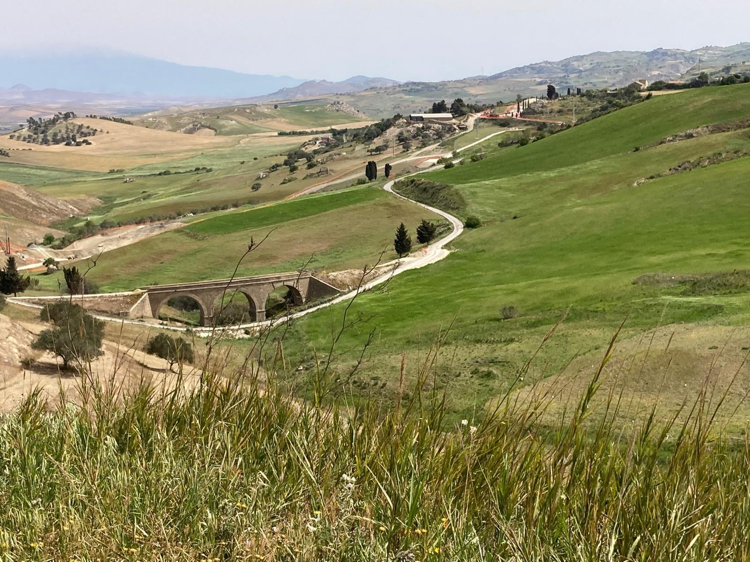
Al bivio azzeriamo il computerino della bici e inizia il terzo tratto del percorso, la cui lunghezza complessiva sarà pari a 5,4 km, fino alla strada di Passo Cerasaro. Dal bivio prendiamo a sinistra. Dopo circa un chilometro scendiamo in un vallone, un passaggio reso riconoscibile anche da un tubo metallico sospeso. Si risale, per pedalare su un fondo finalmente ben bitumato e per incontrare un bivio al km 1,4 km. Prenderemo a destra (ovest) e l km 5,4 troveremo la strada “Passo Cerasaro”.
All’incrocio azzeriamo nuovamente e partiamo per la quarta parte del percorso e puntiamo verso la SP 10. Il fondo dapprima è bitumato scorrevole, poi al km 2,8 la strada sterra, con punti fangosi, in particolare quello del km 4,5. Il bivio con la SP 10 si raggiunge dopo 4,9 km.
Giunti al bivio con la SP 10 si azzera e inizia la quinta parte del percorso. Si prende a sinistra e a 750 m si incontra l’interruzione dovuta alla frana che più avanti ha colpito Niscemi. Senza infrangere il divieto, svoltiamo sulla destra per imboccare la SP 82. L’impressione è che più ci si addentra nelle piane e più aumenta il rischio di fango, peraltro molto argilloso e dunque capace di bloccare ogni veicolo già alla prima pioggia. Dopo aver percorso 4,8 km si raggiunge il bivio con la SP 35.
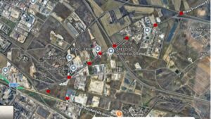
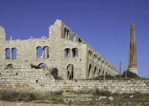
Qui si azzera nuovamente, per iniziare la sesta parte del percorso. Si oltrepassa la SP 35 e si prosegue in direzione sud sulla SP 82. Dopo 7 chilometri e varie pozze di fango si entra nell’area industriale di Gela e si arriva alla SS 115, a circa 1,8 km dall’entrata dell’abitato o meglio della rotatoria posta all’accesso est di Gela.
Conclusioni e Prospettive. Il tracciato si sviluppa per circa 37 km, discendendo dalla quota di 555 a circa 7 metri slm, concentrando la maggior parte della pendenza nei primi 7 km dalla partenza presso il Museo Hoffmann di Caltagirone. Attraversa in direzione nord – sud una ampia vallata, contornata a est dai monti sui quali sorge Niscemi; mentre, nella stessa depressione, più a ovest corre la SS 117, a tratti visibile. Si snoda per aree molto argillose, che renderanno dopo una pioggia il passaggio molto difficoltoso anche a piedi. Al momento del sopralluogo, dunque a fine aprile, l’intera vallata e i monti che la contornano sono coperti di verde, ma in estate l’ambiente sarà molto arido e le temperature difficili da sostenere. Per cui, il periodo migliore per transitare sul percorso si riduce al mese di maggio e, ponendo attenzione alle possibili giornate di forte caldo, fino a metà giugno, per riprendere a ottobre, sempre se non è intervenuta la pioggia a bagnare le argille. L’arrivo nell’area industriale, peraltro in una zona ove avverranno a breve lavori sulla viabilità, non appare adatto all’escursionismo, se non addirittura pericoloso.
Valutando nel complesso tutti i fattori enunciati, proseguiremo la ricerca di altri itinerari per includere Caltagirone al GREENET.
From Caltagirone (SP 194) to Gela (SS 115) via country roads
260428 – GREENET – From Caltagirone SP 194 to Gela SS 115 up
GREENET is the abbreviation for “GREENET – NETWORK OF GREENWAYS IN SICILY, or a Strategy for reconnecting areas of excellence through intermodal soft mobility”, based on secondary roads, dirt tracks and disused railway lines. This is a strategic project unanimously approved by the UNESCO municipalities at their plenary session held in December 2014 in the Council Chamber of Catania City Hall. In addition to UNESCO sites, GREENET aims to interconnect cultural landmarks of significant interest within the region.
GREENET is establishing a hub in Agrigento, as this city – so significant to the history of the ancient world – divides Sicily perfectly into two parts. Caltagirone is a UNESCO World Heritage site, forming part of the ‘Late Baroque Towns of the Val di Noto’ serial site, and any GREENET initiative – specifically, sustainable transport routes to Sicily’s World Heritage sites – must be able to reach it.
A potential route linking Agrigento and Caltagirone was the focus of the site visit on Friday 24 April. In particular, the aim was to assess the viability of the route between Caltagirone and Gela via provincial roads 194 (Passo Cerasaro), 10, 35 and 82. Below is the report, followed by the final assessment of the route.
The journey begins in Caltagirone, where, at the Fornace Hoffmann – the point indicated by the sat-nav – you take the SP 194 towards the Santuario – or Convento – del Soccorso. A 4.8 km stretch of narrow, winding downhill road, but perfectly tarmac-surfaced, which over 4.8 km drops from an altitude of 555 m above sea level to 255 m, with local peaks exceeding the respectable average gradient of 5.3%.
Let’s reset the odometer and set off from the Sanctuary for the second section, which ends at the junction reached after 10 km. The route alternates between dirt tracks and tarmac, and there are several clay patches which, as might be expected, will become impassable even after just a little rain. Of interest is the regional weather network station encountered at km 4.6, with a (clayey) clearing, buildings and a footbridge over the valley; the long drinking trough at km 5.0 is useful, which to this day has a tiny active water spout, albeit made barely visible by the lush vegetation covering the basin. At km 7, a large metal pipe, visibly damaged and out of use, runs alongside the track we are following; at km 8.4, a stony embankment does little to dispel doubts about the track’s impassability in the event of rain. At km 9, we pass a junction leading to the right towards an elevated housing block and, finally, at km 10, the junction where we turn left (east, as our journey is heading south). Clearly visible to our left lies the plateau where the village of Niscemi is situated.
At the junction, we reset the bike computer and begin the third section of the route, which is 5.4 km in total, leading to the Passo Cerasaro road. From the junction, we turn left. After about a kilometre, we descend into a valley, a passage also marked by a suspended metal pipe. We climb back up, cycling on a surface that is finally well-asphalted, and come to a junction at 1.4 km. We turn right (west) and at 5.4 km we find the “Passo Cerasaro” road.
At the junction, reset your distance and set off on the fourth section of the route, heading towards the SP 10. The surface is initially smooth tarmac, then at 2.8 km the road turns to gravel, with muddy patches, particularly at 4.5 km. The junction with the SP 10 is reached after 4.9 km.
On reaching the junction with the SP 10, the odometer is reset and the fifth section of the route begins. We turn left and, after 750 metres, come to the roadblock caused by the landslide that later affected Niscemi. Without breaking the rules, we turn right onto the SP 82. The impression is that the further you venture into the plains, the greater the risk of mud, which is, moreover, very clayey and therefore capable of stalling any vehicle at the first sign of rain. After travelling 4.8 km, you reach the junction with the SP 35.
Here, the route resets again to begin the sixth section. You pass the SP 35 and continue south on the SP 82. After 7 kilometres and several mud puddles, you enter the industrial area of Gela and reach the SS 115, about 1.8 km from the entrance to the town, or rather the roundabout at the eastern entrance to Gela.
Conclusion and Perspectives. The route covers approximately 37 km, descending from an altitude of 555 metres to around 7 metres above sea level, with most of the gradient concentrated in the first 7 km from the start. It crosses a wide valley from north to south, bordered to the east by the mountains on which Niscemi stands; whilst, in the same depression, further west runs the SS 117, visible in places. It winds through very clayey areas, which, after rain, will make passage unlikely even on foot. At the time of the site inspection, therefore in late April, the entire valley and the mountains surrounding it are covered in greenery. In summer, the environment will be very arid and the temperatures difficult to bear. Consequently, the best time to traverse the route is limited to the month of May and, taking care to avoid days of intense heat, until mid-June, resuming in October, provided the rain has not softened the clay. The arrival at the industrial estate – which, incidentally, is in an area where roadworks are due to start shortly – does not appear suitable for hiking, and may even be dangerous. Taking all the factors mentioned into account, we will continue our search for other routes to include Caltagirone in the GREENET network.
Giambike on Komoot
Prima parte – Part One

Seconda parte – Part Two

Terza parte – Part Three

Quarta parte – Part Four

Quinta parte – Part Five
Qui su google l’innesto del percorso alla strada statale SS 115, del tutto sconsigliabile per motivi di sicurezza. Come scritto sopra, cercheremo un altro percorso adatto alle bici per unire le città di Caltagirone e Gela.
Here on Google, the route joins the SS 115 main road, which is strongly discouraged for safety reasons. As mentioned above, we will look for another cycle-friendly route to link the towns of Caltagirone and Gela.


