
Bikepacking sul Cammino di San Giacomo in Sicilia
Bikepacking people along the Way of St James in Sicily
Bikepacking sul Cammino di San Giacomo in Sicilia
Bikepacking people along the Way of St James in Sicily
Da tempo desideravo intraprendere in bikepacking il Cammino di San Giacomo fra le due città siciliane di Caltagirone e Capizzi. La prima, nota per le preziose ceramiche e appartenente al sito UNESCO Città Tardo Barocche del Val di Noto. La seconda, cittadina medioevale ricca di storia e porta meridionale dei Monti Nebrodi, con la cima arroccata a oltre 1100 metri di altitudine. Fra le due, una Via Francigena resa celebre in poco tempo grazie all’impegno di Totò Trumino e del suo gruppo di lavoro. Lo devo a un invito di Angelo, titolare della omonima ciclofficina calatina, se sono divenuto il quarto di un gruppetto formato anche da Giorgio e Michele, rivelatisi tutti e tre ottimi compagni di viaggio.

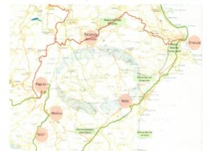
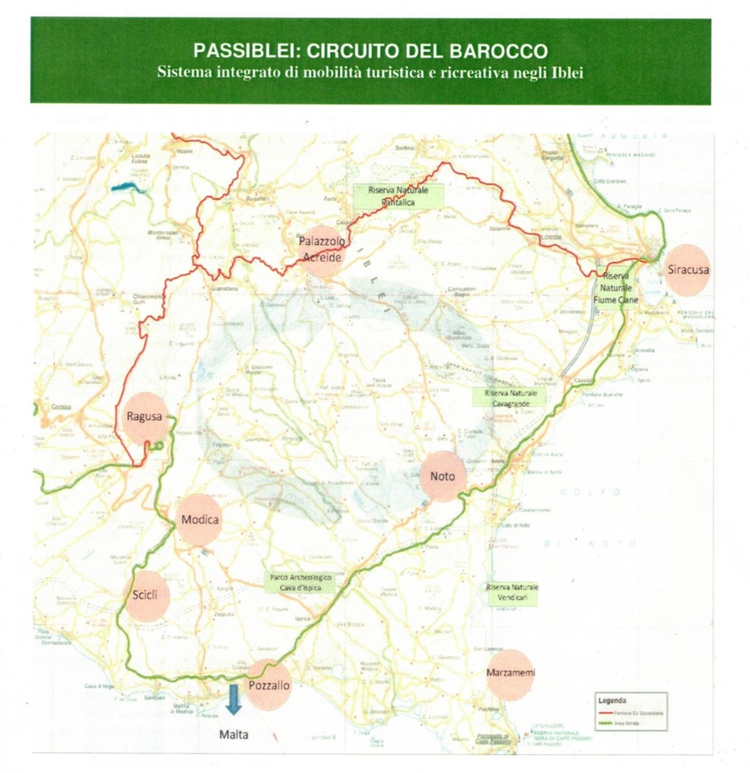
La distanza media giornaliera che può essere percorsa da un viaggiatore a piedi si aggira sui 20 chilometri e non sarà un caso se le sei città sono poste a questa distanza reciproca, come perle di una preziosa collana costruita dai viandanti nei secoli. Il recapito di ciascuna delle sei tappe rispetta infatti questo criterio: Caltagirone – Mirabella Imbaccari (19 km), passando da San Michele di Ganzaria; Mirabella I. – Piazza Armerina (21 km); Piazza A. – Valguarnera Caropepe (19 km, con possibile allungamento verso Aidone); Valguarnera C. – Assoro (25 km); Assoro – Nicosia, passando per Nissoria (25 – 32 km); Nicosia – Capizzi (17 km), per un totale di circa 130 km. Per i particolari si rimanda all’ottimo sito “camminosangiacomosicilia” e alla pubblicazione “Il Cammino di San Giacomo in Sicilia”, scritto a quattro mani fra il citato Totò Trumino e Giuseppe Riggio per le edizioni “Terre di Mezzo”.
In bicicletta le tappe possono comodamente ridursi a tre, ognuna mediamente di 40 – 45 km, con pernotti a Piazza Armerina e Assoro, due centri dove la Storia ha impresso segni profondamente differenti fra loro, ma altrettanto coinvolgenti per chi vi si trova a passare. Una distanza tutto sommato modesta, ma che non deve indurre a sottovalutarne la difficoltà provenienti dalle pendenze e dal fondo di alcuni tratti; difficoltà che possono essere acuite dalle temperature e più in generale dalle condizioni meteo talvolta aspre della Sicilia interna e collinare.
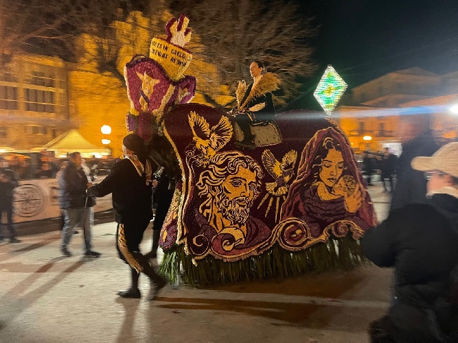
La mattina di sabato è lavorativa e così partiamo nella prima metà del pomeriggio, e subito occorrono le immancabili soste sul sagrato della Chiesa di San Giacomo prima, e per la foto di rito davanti agli ex voto poco dopo.
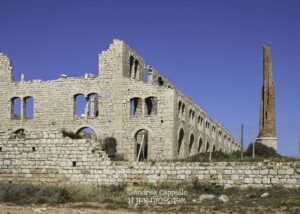
Per uscire da Caltagirone dobbiamo necessariamente accontentarci della discesona sulla strada statale 124 e porre la massima attenzione alla confluenza con la via Balchino che giunge dalla destra, da un angolo che è difficile controllare… ma noi siamo già nel mood del Cammino e affrontiamo questi primi disagi con la serena sopportazione del ciclo – pellegrino. Ancora pochi chilometri e presto ci accoglie quella che fu una delle più premiate greenway d’Europa inaugurata nel 2001, ricavata sulla linea ferroviaria dismessa Caltagirone – Dittaino, e oggi speriamo solo temporaneamente sconvolta dal transito dei mezzi pesanti del vicino cantiere per la nuova superstrada. Chi scrive la ricorda appena costruita, nel momento del massimo splendore in una intervista voluta da RAI 3. Onore al Sindaco di San Michele di Ganzaria, che ha emesso una ordinanza di divieto al traffico pesante; di sicuro, qui è richiesto un miracolo terreno, volto al ripristino agli antichi allori. Nutriamo la speranza che possa avvenire nel futuro, magari sotto forma di compensazione per i disagi patiti.
Ma già ci ripaga l’ampio paesaggio che a nord si apre sulle cime boscose dove, non viste, si distendono le preziose città di Piazza Armerina e di Aidone, prossime mete, e mentre ogni pedalata ci avvicina a San Michele, sempre di più il ritmo della natura circostante ci porta con sé. Siamo ora vicinissimi ai fabbricati della antica Stazione ferroviaria e appena dopo il passaggio sotto l’arco di pietra torniamo a gomito sulla destra per imboccare una stradina che passerà proprio sopra quell’arco. Una rampa breve e intensa, ulteriori passaggi ancora in salita nella periferia del centro abitato ed ecco appare di fronte a noi il Bar Nazionale, posto sulla omonima via e reso famoso dalle “banane”. Vere squisitezze “internazionali” (nel senso di strepitose) costituite da lunghi bignè ripieni di squisita crema, nonché punto di riferimento per la timbratura della credenziale.
Con leggera digressione dall’itinerario passiamo dalla bella palestra comunale, dove Giuseppe Lo Tauro allena una squadra di quel fantastico sport che è la pallavolo. Qui da Giuseppe e da Angelo, organizzatori della Granfondo degli Erei, ricevo l’inaspettato e graditissimo omaggio di una maglietta tecnica della Granfondo, un capo che io avevo ammirato sul web senza immaginare che ne avrei avuta una in regalo per puro spirito di amicizia. Ancora una volta San Michele mostra di non aver dimenticato le otto granfondo, le tante ciclo escursioni, il divertentissimo orientamento in bici che come Acquaterra “Montainbike” (scritto proprio così) prima e “Montainbike” Sicilia organizzammo qui a partire dal 1999, con la piena ed entusiastica collaborazione delle istituzioni locali.
Lasciata San Michele, l’impegno si fa più serio, visto che il crollo di una arcata dell’antico ponte ferroviario obbliga a deviazioni, per poi rientrare sul sedime che, senza particolari difficoltà ci porterà a Mirabella Imbaccari. Qui, per raggiungere il centro bisogna salire, e scopriremo che questo avverrà ogni altra volta, visto che i municipi o i comunque i punti timbro si trovano tutti nei cocuzzoli delle città raggiunte dal Cammino.
Siamo al Bar Vespri e scambiamo quattro chiacchiere con i numerosi avventori seduti al riparo di ampi ombrelloni. Prima di partire ci sediamo un paio di minuti sulla scalinata della chiesa antistante, giusto il tempo di una ripresa con il mini drone di Angelo, poi via, anche perché sono già le sei e mezza del pomeriggio, le giornate sono diventate lunghe, ma non poi troppo.
Ci troviamo adesso in un tratto del percorso dove deve essere passato un trattore con un attrezzo a dischi, erpice o aratro che sia, e quello che avrebbe potuto essere un quieto transito ora è un massaggio a vibrazione intensa, specie per me che sono su gravel con forcella rigida! Una rampaccia con fondo di pietre lisce costringe tre di noi quattro alla spinta, ma dura poco e viene il momento in cui la strada camionabile ci accoglie. Michele è andato avanti, Angelo e Giorgio sono più indietro e così, non scorgendo l’uno e non vedendo gli altri, proseguo a testa bassa fino a raggiungere Piazza Armerina e l’hotel dove abbiamo prenotato per la notte. È sera, ma loro arriveranno quando sarà ancora più sera… vengo a sapere che non ho visto un segnale del Cammino che indicava una deviazione verso una salitona che io mi sono risparmiato, ma che a loro è costata fatica e tempo. Che dire, mi spiace… ma devo ammettere che non ci piango sopra! Devo però anche aggiungere che il Cammino è molto ben segnalato e non vedere quella freccia è stata solo una mia distrazione.
La doccia e poi e la cena nel centro storico sono i momenti migliori, dopo esserti ripulito e rinfrescato vedi gente, incontri persone, gusti i sapori e perché no, i rumori – o suoni – dei luoghi. Vai a letto ben ricompensato delle fatiche e la mattina ti svegli con tanta voglia di ricominciare.
E infatti, siamo al secondo giorno e si ricomincia, con la prima parte del percorso priva o quasi di difficoltà in termini di pendenze, ma che mi obbliga più volte a scendere dalla bici perché il fondo sabbioso mal si sposa con le coperture slick che ho improvvidamente lasciato montate sulla bici. Anche quando la terra si fa battuta e in leggera discesa, decido di mantenere andature moderate per evitare di essere disarcionato dalle lenti di sabbia che improvvise appaiono sulla pista. Dopo quieti altarini e le Pietre Incantate, lo sterrato punta a est, verso Aidone, ma poi decisamente verso nord, attraversando la Statale 288 per inoltrarsi ancora nel bosco di eucalipti che continua ad accompagnarci dalla periferia di Piazza Armerina. In un paio di casi, accentuate pendenze hanno trasformato il sentiero in accidentati e stretti scivoli che le piogge invernali hanno eroso. Qui si procede bici a mano e io, che sono l’unico con pedalata assistita, ringrazio la funzione di “assistenza attiva” nei tratti a spinta; funzione che, scopro in queste circostanze, non è utile solo in salita, ma anche nelle discese accidentate.
Non molto dopo, una discesa dal fondo regolare invita a prendere velocità ed ecco che ben presto ci ritroviamo sulla trafficata SP 4, a poca distanza della galleria, che attraverseremo di corsa e accendendo tutte le luci disponibili. Ci rendiamo conto che l’allegria della discesa non ci ha fatto vedere il segnale, che adesso qualcuno sostiene di avere intravisto, verso una deviazione che ci avrebbe fatto scavalcare la collina senza entrare sulla camionabile.
La faccia buona della medaglia è che pedalando in velocità sulla strada asfaltata e in leggera discesa, in pochi minuti ci ritroviamo a Valguarnera Caropepe, dove ancora una volta saliamo fin su, a trovare un gentilissimo signore che appone i timbri e mette a disposizione un bagno con provvidenziale rubinetto di acqua freschissima, dove inzupperò la bandana per poggiarla sul collo e sulle tempie, piacevole rito rinfrescante di tutti i bikers fortemente accaldati.
Non siamo stanchi, ma fa piacere sapere che dopo Valguarnera ci attende una lunga discesa su stradina secondaria semi asfaltata. Così, ci ritroviamo presto nell’area del Dittaino, dove industrie chiuse e silenziosi cantieri della nuova linea ferroviaria – è domenica – ci accolgono. Nell’ampia camionabile bisogna ora fare attenzione a seguire le frecce in vernice gialla, fino a trovare la ben visibile segnaletica stradale per Assoro, verso nord, meta finale della seconda giornata. Dittaino è il punto più basso del percorso (250 m slm), ci predisponiamo alla risalita verso Assoro (850 m slm).
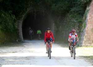
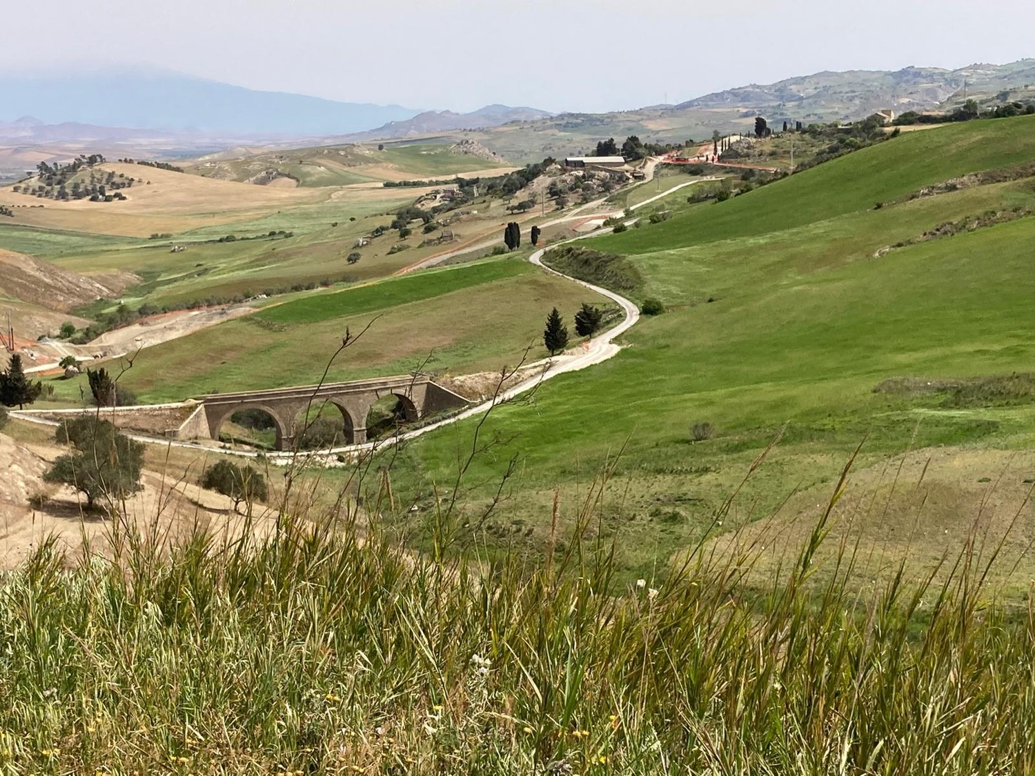
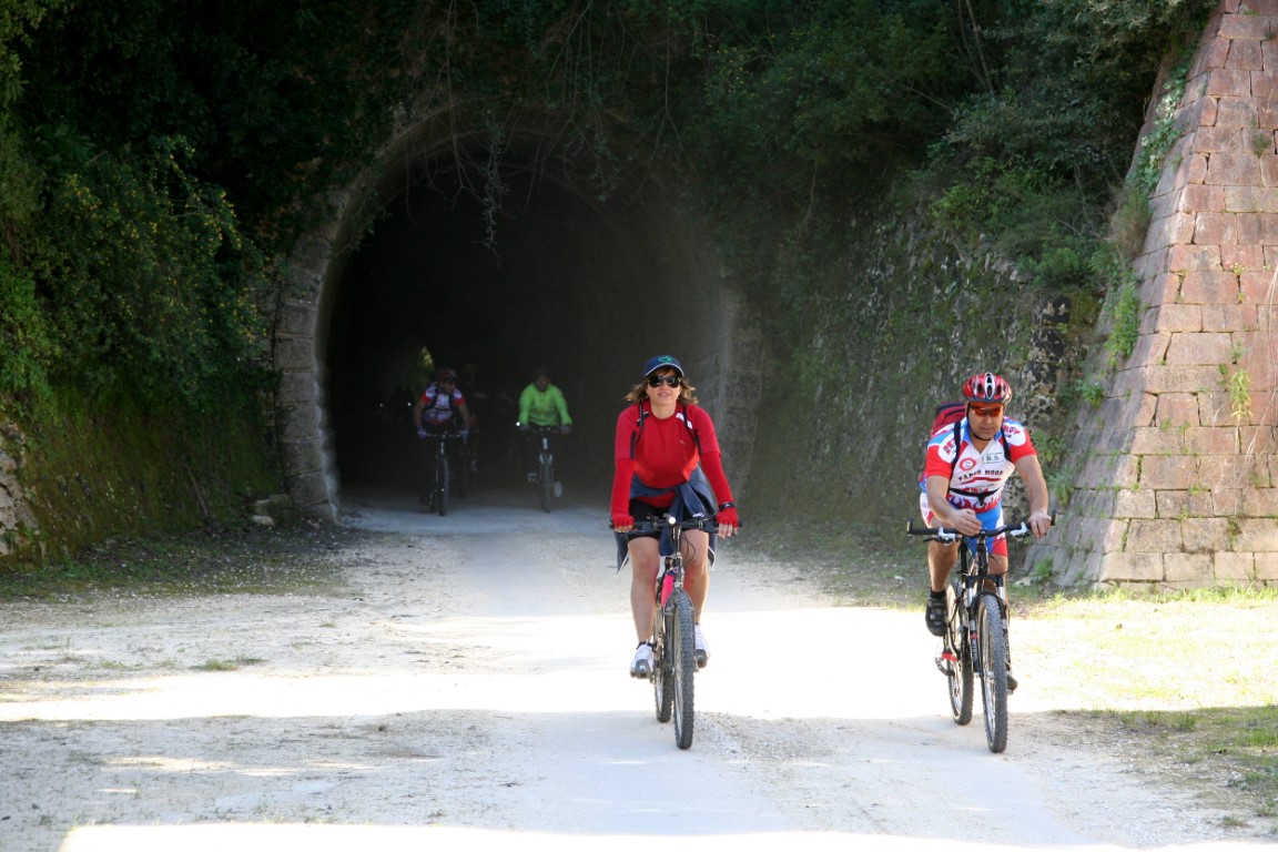
Passiamo la ferrovia che taglia la Sicilia est ovest unendo Catania e Palermo, e sottopassiamo l’autostrada. Poco dopo accetto il saggio suggerimento di Angelo di non pretendere troppo dalla mia pur ottima gravel e prendo la strada camionabile a destra, per Assoro. Gli amici, invece, vanno avanti e li aspetterò, più sopra, al fontanone. Anche questa volta verrò a sapere che mi sono risparmiato una gran salitona, di quelle che costringono a scendere e spingere la bici! Giunti al tornante, finalmente imbocchiamo la galleria della ferrovia dismessa e proseguiamo sulla affascinante sede ferroviaria che, con gallerie, spettacolari viadotti e tortuose giravolte, lentamente sale verso Assoro.
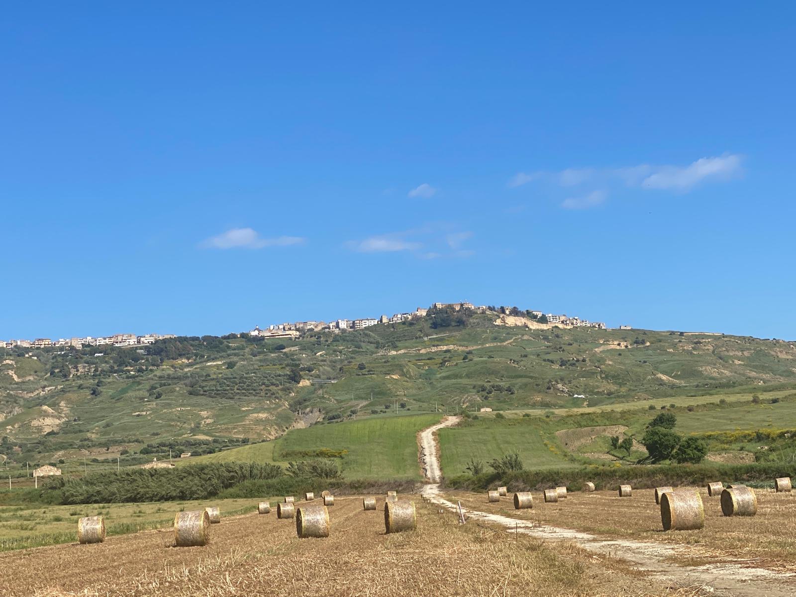
Raggiungere Assoro per l’antica ferrovia è stupore, la salita per il centro città non è breve, ma una volta giunti, se non ci siete ancora stati, lo stupore si moltiplica.
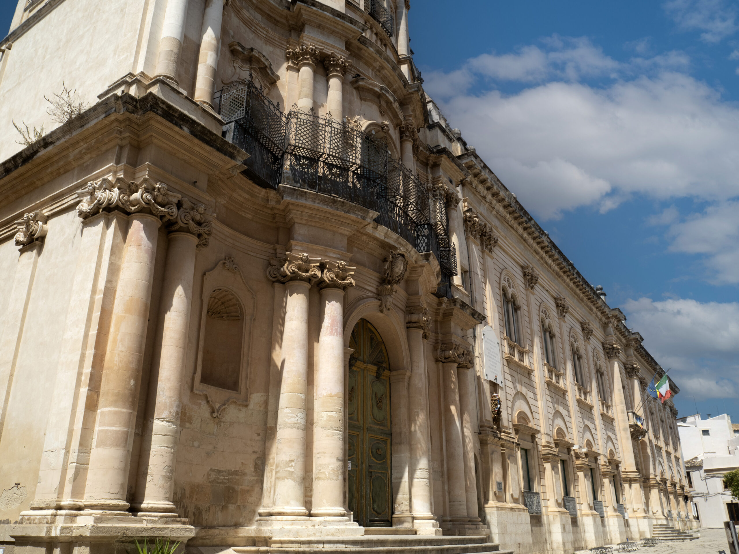
Il Belvedere che si affaccia verso ovest, con l’abitato di Leonforte, e poi Enna e Calascibetta che si stagliano nitide all’orizzonte. Il Palazzo Valguarnera, costruito a partire dal 1492 in stile catalano, con le aggiunte barocche del 1538, che un arco in pietra unisce alla straordinaria Basilica di San Leone. La vista e l’attenzione sono catturate dai murales, gigantografie che rappresentano la vita nelle miniere di zolfo che costellano il territorio ormai inattive da gran tempo, compreso quello gigante nel cortile interno del Municipio, dove vi è la sede della Pro Loco, che su una intera parete mostra la miniera di monte Zimbalìo. Altra piacevole sorpresa è il signor Giacinto, disponibile, simpatico e professionale, il cui BB comprende un garage sicuro per le bici, con accesso diretto senza faticosi gradini da superare e due passi dal centro.
Dopo i maccheroni di Piazza Armerina, stasera è il momento di una buona pizza e il locale in piazza Belvedere ci soddisferà pienamente, come la notte che ci attende nel BB di Giacinto.
Tanto si sale e tanto si scende, verrebbe da dire, se non fosse che per la gran pendenza è dura salita, mentre in discesa alle ruote pensa la gravità, e così bellamente accade la mattina di lunedì. Discesi in pochi minuti i pendii che ci avevano impegnati la sera prima, arriviamo alla base della rocca sulla quale risiede la città, ignoriamo il bivio a sinistra per Leonforte e, dopo circa 600, metri, all’altro bivio, prenderemo lo sterrato che piega a nord est con rampette subito in salita.
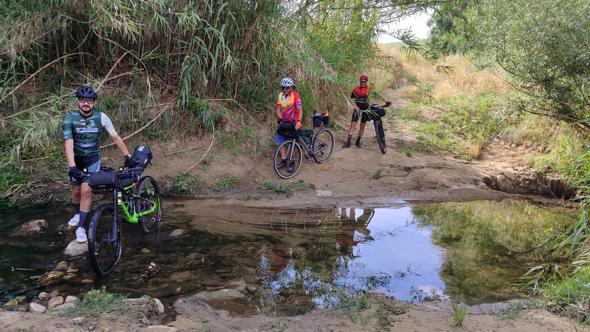
Il percorso si fa ora meno aspro, pedalabile e gradevole e senza mai lasciare la pista principale raggiungiamo Nissoria, famosa per i suoi murales, dove al Municipio una gentile signora timbrerà le credenziali. Brevissima sosta bar e via verso la periferia est della città, dove prendiamo la SS 121 per lasciarla quasi subito andando a nord, direzione Nicosia. Scendiamo fiduciosi, fino a che la confortante freccia gialla del Cammino ci invita a lasciare la camionabile per uno sterrato alla nostra sinistra. Saliscendi, fino a che una lunga discesa dall’improbabile pendenza ci recapita a sorpresa al fiume Salso, che oggi è di buon umore e si fa guadare molto facilmente. Di solito tanto mi dà tanto, ma in questo caso, per fortuna, la pendenza della risalita è molto meno traumatica.
Si pedala un bel po’, ma oggi la temperatura, almeno secondo i mei standard, è molto sopportabile, e si va avanti senza soffrire (bisogna dire però che ho da tempo attivato il livello minimo di assistenza alla pedalata). L’ambiente circostante, il silenzio, il paesaggio ampio e aspro mi sollecitano un triste canto a gola piena … Angelu era e non avia ali … Michele, per le stesse mie ragioni, cerca il silenzio e cerca di distanziarmi per non dovermi sentire, mi dirà dopo, ma le vallate, nell’aria tersa, risuonano. Santu non era e miraculi facìa, e forse in quel punto la salita richiedeva un piccolo miracolo. In cielu acchianava senza cordi e scali . E finiva la salita. E senza appidamenti ni scinnia. Una discesa lunga e ripida e lunga, e finalmente, Nicosia ci accoglie, e l’ombra degli alberi della piazzetta ci assiste mentre divoriamo i panini acquistati nella vicina drogheria. Io, che praticamente ignoro l’esistenza della Coca Cola, da due giorni ne faccio incetta, canna o vetro che sia.
I chilometri e i dislivelli accumulati nelle gambe non significano automaticamente stanchezza e siamo pronti per il “balzo” verso Capizzi, ultima tappa di questo viaggio avvincente sotto tutti gli aspetti possibili.
Un ragazzo incontrato al banco della salumeria per un attimo ci destabilizza consigliandoci caldamente di andare per la strada camionabile, perché le pendenze delle vie del Cammino sono “improponibili” … ma non pensiamo nemmeno per un momento di demordere! E poi, sarà veramente così? Ebbene… è così! O quasi così, visto che l’ultima, e lunga, salita raggiunge pendenze del 20%. Però, poco prima di risalire, San Luca dalla sua sobria cappelletta sembra volerci incoraggiare. Gli amici si attardano a rinfrescarsi nel torrente, io preferisco ripartire per affrontare quel lungo e stretto nastro d’asfalto che visto dalla cima della collina di fronte fa tremare le vene dei polsi.
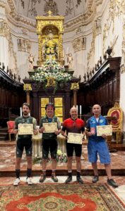
Non si rivelerà un problema per me, che imposto il livello minimo di assistenza e mi limito a un ritmo basso e costante di pedalata che metro dopo metro mi porterà fin su senza alcun problema. Ad ogni giro di pedale, per la verità, penso ai miei amici, alle loro bici “normali” e a come finiranno per scontare la frescura del torrente con il susseguirsi di queste pendenze. Quando sembra sei arrivato, ci sarà ancora un bel po’ da pedalare, perché alla Chiesa Madre di San Giacomo Maggiore, dove si custodiscono le reliquie del Santo, ho scelto di arrivare dopo un lungo giro per la circonvallazione della città. Ho tutto il tempo di un ottimo gelato artigianale e … altra Coca cola, prima che arrivi Michele, seguito a distanza da Angelo e Giorgio. Ottimi pedalatori, in fondo non poi tanto provati. Non resta ora che attendere il simpaticissimo signor Marcello, che dopo aver verificato i timbri sulle credenziali, consegnerà a ciascuno di noi l’Aurea Jacopea, il certificato ufficiale rilasciato a chi porta a termine il Cammino di San Giacomo in Sicilia. Abbiamo iniziato sabato pomeriggio e ora terminiamo il nostro Cammino in bici nel primo pomeriggio di lunedì.
Secondo me, in bici una parte della spiritualità viene assorbita dal procedere speditamente per rientrare nei tempi. Forse, a piedi hai più agio di calarti negli stordenti paesaggi della Sicilia interna?
È stato impegnativo? In più di un punto e nel complesso: si. Si può fare in gravel, bici usualmente non ammortizzata? Si, con coperture adatte, non con le slick che ho utilizzato io. È segnato bene? Si. Si fanno buoni incontri? Si, poi per me davvero ottimi incontri, da Giuseppe a San Michele ai miei due carissimi ex studenti che, a Assoro e a Capizzi, mi hanno riconosciuto e salutato, nonostante la “bardatura” da ciclista; il secondo incontrato davanti alla Chiesa con la gentile compagna, in vista del matrimonio. Quanto conta la buona compagnia? Molto. Angelo, Giorgio e Michele sono stati compagni perfetti. Domanda che mi è stata posta lunedì sera, al termine del Cammino: lo rifaresti? No, va bene una volta. Stessa domanda, il lunedì successivo. Risposta: si.
Infine: sono disponibili molte tracce del Cammino pubblicate dai pellegrini, senza dubbio occorre scaricare le tracce ufficiali e, perché no, portarsi dietro la Guida, molto chiara e esaustiva.
giampaolo.schillaci@baroccoslowcoast.it
Bikepacking people along the Way of St James in Sicily
I had long wanted to cycle the Way of St James in Sicily, from Caltagirone to Capizzi. The first town, renowned for its exquisite ceramics, is part of the UNESCO site ‘Late Baroque Towns of the Val di Noto’. The second is a medieval town steeped in history, perched in the heart of the Nebrodi Mountains, with its highest point at an altitude of 1,139 metres. In between lies a section of the Via Francigena that has quickly gained fame thanks to the efforts of Totò Trumino and his team. It was thanks to an invitation from Angelo, owner of the Caltagirone-based bike workshop bearing his name, that I became the fourth member of a small group that also included Giorgio and Michele – all three of whom proved to be excellent travelling companions.
The average daily distance that a traveller can cover on foot is around 20 kilometres, and it is no coincidence that the six towns are situated at this distance from one another, like pearls on a precious necklace strung together by travellers over the centuries. The route for each of the six stages indeed follows this criterion: Caltagirone – Mirabella Imbaccari (19 km), via San Michele di Ganzaria; Mirabella Imbaccari – Piazza Armerina (21 km); Piazza Armerina – Valguarnera Caropepe (19 km, with a possible extension towards Aidone); Valguarnera C. – Assoro (25 km); Assoro – Nicosia, via Nissoria (25–32 km); Nicosia – Capizzi (17 km), making a total of approximately 130 km. For further details, please refer to the excellent website “camminosangiacomosicilia”.
By bike, the stages can easily be reduced to three, each averaging 40–45 km, with overnight stays in Piazza Armerina and Assoro, two towns where history has left its mark in profoundly different yet equally captivating ways for those passing through. All in all, it is a modest distance, but this should not lead one to underestimate the difficulties posed by the gradients and the road surface on certain stretches; difficulties that can be exacerbated by the temperatures and, more generally, by the sometimes harsh weather conditions of inland, hilly Sicily.
Saturday morning is a working day, so we set off in the early afternoon, and straight away we make the inevitable stops – first in the churchyard of the Church of San Giacomo, and shortly afterwards for the customary photo in front of the ex-votos.
To leave Caltagirone, we have no choice but to make do with the steep descent along State Road 124 and pay the utmost attention to the junction with Via Balchino, which joins from the right at a blind corner… but we are already in the spirit of the Camino and face these initial difficulties with the calm resilience of the cycling pilgrim. Just a few more kilometres and we are soon greeted by what was once one of Europe’s most acclaimed greenways, now marred by the heavy goods traffic from the nearby construction site for the new motorway. The author presented the greenway at the height of its splendor in an interview on RAI 3, and I can assure you that he feels genuine dismay. Credit is due to the Mayor of San Michele di Ganzaria, who issued an order banning heavy goods traffic; certainly, a miracle is needed here to restore it to its former glory. Can we hope that this might happen in the future, perhaps in the form of compensation for the inconvenience suffered?
But we are already rewarded by the sweeping landscape to the north, which opens out onto the wooded peaks where, hidden from view, lie the beautiful towns of Piazza Armerina and Aidone; and as every pedal stroke brings us closer to San Michele, the rhythm of the surrounding nature draws us in ever more deeply. We are now very close to the buildings of the old railway station and, just after passing under the stone arch, we take a sharp right-hand bend to join a narrow road that runs directly over that arch. A short, steep climb, followed by further uphill sections on the outskirts of the town, and there before us appears the Bar Nazionale, situated on the street of the same name and made famous by its ‘bananas’. These are true ‘international’ delicacies (in the sense of being absolutely brilliant) – long cream puffs filled with exquisite cream – and also a key stop for getting our credentials stamped. Taking a slight detour from the route, we pass the lovely municipal sports hall, where Giuseppe Lo Tauro coaches a team in that fantastic sport, volleyball. Here, from Giuseppe and Angelo – organisers of the Granfondo degli Erei – I receive the unexpected and most welcome gift of a Granfondo technical T-shirt, an item I’d admired online without ever imagining I’d be given one as a present purely out of friendship. Once again, San Michele shows that it hasn’t forgotten the eight Granfondo events, the many cycling excursions, and the hugely entertaining bike orienteering events that we organised here – first as ‘Acquaterra “Montainbike”’ (spelt exactly like that) and later as Montainbike Sicilia – starting back in 1999! (“Monta-in-bike” means “ride a bycicle”).
Once we’ve left San Michele, the going gets tougher, as the collapse of an arch of the old railway bridge forces us to take detours and cross a little stream (I can’t rule out the possibility that, due to a momentary lapse, we made a small mistake along the way), before rejoining the route, which will take us to Mirabella Imbaccari without any particular difficulty. Here, to get the downtown , we have to climb uphill, and we’ll find that this will be the case every time, as the town halls – or at least the stamp points – are all situated at the highest points of the towns reached by the Camino. We’re at Bar Vespri, having a natter with the many customers sitting in the shade of large parasols. Before setting off, we sit for a couple of minutes on the steps of the church opposite, just long enough for a quick shot with Angelo’s mini drone, then off we go – not least because it’s already half past six in the afternoon; the days have grown longer, but not too long.
We’re now on a stretch of the route where a tractor must have passed, fitted with a disc implement – be it a harrow or a plough – and what might have been a smooth ride is now an intense vibrating massage, especially for me on my gravel bike with a rigid fork! A steep climb with a surface of smooth stones forces three of the four of us to push our bikes, but it doesn’t last long and soon a paved road comes into view. Michele has gone ahead; Angelo and Giorgio are further back, so, unable to see the one in front or the others behind, I carry on with my head down until I reach Piazza Armerina and the hotel where we’ve booked for the night. It’s evening, but they’ll arrive when it’s even later… I find out that I missed a sign on the Cammino indicating a detour towards a steep climb that I managed to avoid, but which cost them both effort and time. What can I say, I’m sorry… but I have to admit I’m not exactly heartbroken about it! I must also add, however, that the Camino is very well signposted and missing that arrow was simply down to my own distraction.
A shower, followed by dinner in the old town, are the best moments: once you’ve cleaned up and freshened up, you see people, meet others, savour the flavours and – why not? – the noises – or sounds – of the place. You go to bed feeling well rewarded for your efforts, and in the morning you wake up eager to start all over again.
And indeed, it’s the second day and we’re off again, with the first part of the route presenting little or no difficulty in terms of gradients, but forcing me to dismount several times because the sandy surface doesn’t go well with the slick tyres that I’d unwisely left fitted to the bike. Even when the ground becomes compacted and slightly downhill, I decide to maintain a moderate pace to avoid being thrown off by the patches of sand that suddenly appear on the track. After the ‘Quieti Altarini’ and the ‘Pietre Incantate’, the track heads east towards the small and lovely town of Aidone, but then turns decisively north, crossing the SS 288 to venture once more into the eucalyptus forest that has been accompanying us since the outskirts of Piazza Armerina. On a couple of occasions, steep gradients have turned the path into rough, narrow slides eroded by the winter rains. Here we have to walk our bikes, and I – being the only one with an e-bike – am grateful for the ‘active assistance’ function on the sections where we have to push; a function which, I discover in these circumstances, is not only useful on climbs but also on rough descents.
Not long after, a smooth downhill stretch tempts us to pick up speed, and before we know it we find ourselves where we shouldn’t be – on the SP 4, a short distance from the tunnel, which we race through with all our lights on. We realise that, in the excitement of the descent, we failed to spot the sign – which someone now claims to have glimpsed – pointing towards a turn-off that would have taken us over the hill without having to join the “lorry route”.
The upside is that, cycling at speed along the tarmac road on a gentle downhill stretch, in just a few minutes we find ourselves in Valguarnera Caropepe, where once again we head uphill to meet a very kind gentleman who stamps our cards and lets us use a bathroom with a tap providing providential, ice-cold water, which I use to soak my bandana and place it on my neck and temples – an age-old cooling ritual for all overheated cyclists.
We aren’t tired, but it’s nice to know that after Valguarnera a long descent along a semi-tarmacked back road awaits us. So, we soon find ourselves in the Dittaino area, where closed factories and quiet construction sites for the new railway line – it’s Sunday – greet us. On the wide road, we must now take care to follow the yellow painted arrows until we come across the clearly visible road signs for Assoro, heading north, the final destination of the second day. Dittaino is the lowest point on the route (250 m above sea level), so we prepare for the climb up to Assoro (850 m above sea level).
We cross the railway line that cuts across Sicily from east to west, linking Catania and Palermo, and go under the motorway. Shortly afterwards, I take Angelo’s wise advice that I’m asking too much of my – albeit excellent – gravel bike and take the tarmac road on the right, towards Assoro. My friends, on the other hand, carry on, and I’ll wait for them further up, at the large fountain. Once again, I’ll find out that I’ve spared myself a massive climb – the sort that forces you to get off your bike! Once we reach the hairpin bend, we finally enter the disused railway tunnel and continue along the fascinating railway line which, with its tunnels, spectacular viaducts and winding twists and turns, slowly climbs towards Assoro.
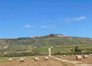
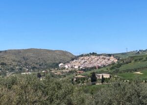
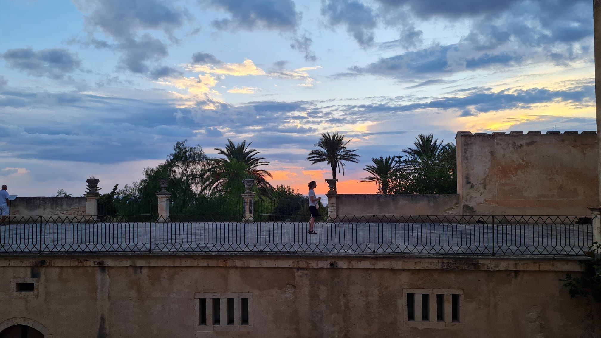
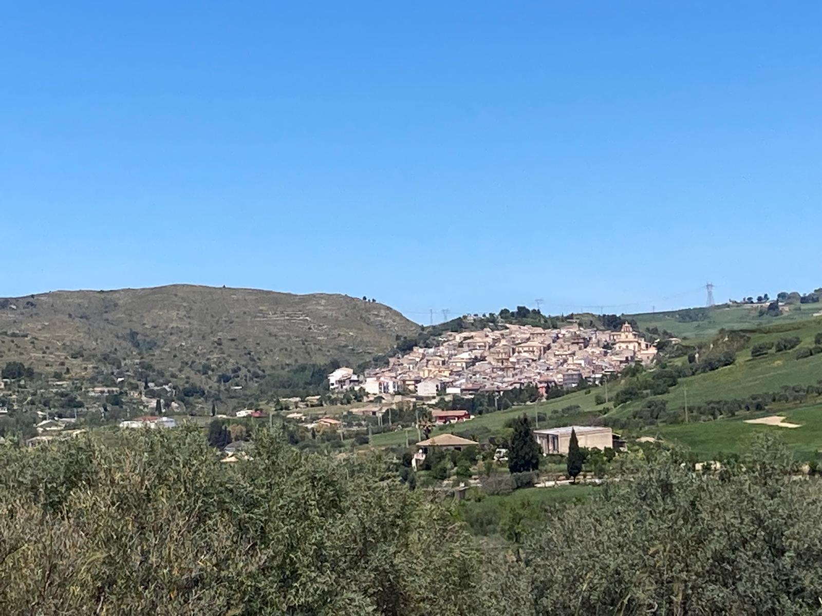
Travelling to Assoro along the old railway line is a marvellous experience; the climb up to the town centre is no short walk, but once you arrive – if you haven’t been there before – your sense of wonder is multiplied.
The Belvedere overlooks the west (“belvedere” is a spot offering stunning views), with the town of Leonforte, and then Enna and Calascibetta standing out clearly on the horizon. Palazzo Valguarnera, built from 1492 onwards in the Catalan style, with Baroque additions dating from 1538, is linked by a stone arch to the extraordinary Basilica of San Leone. Your gaze and attention are drawn to the murals – giant paintings depicting life in the sulphur mines that dot the area, long since disused – including the enormous one inside the Town Hall courtyard, where the Pro Loco office is based, which covers an entire wall with a depiction of the Monte Zimbalìo mine. Another pleasant surprise is Mr Giacinto, who is helpful, friendly and professional, and provides a secure bike garage with direct access – no strenuous steps to climb – just a stone’s throw from the centre.
After the maccheroni in Piazza Armerina, tonight it’s time for a good pizza, and the restaurant in Piazza Belvedere will more than satisfy us, just like the night that awaits us at Giacinto’s B&B.
‘As much going up as going down,’ one might be tempted to say, were it not for the fact that the steep gradient makes for a tough climb, whilst on the descent gravity takes care of the wheels – and that’s exactly how it goes on Monday morning. Having descended in a matter of minutes the slopes that had challenged us the night before, we reach the foot of the rock on which the town stands; we ignore the turn-off to the left for Leonforte and, after about 600 metres, at the next junction, we take the dirt track that bends north-east, with a series of short, steep climbs straight away.
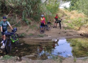
The route now becomes less rugged, easier to cycle and more pleasant, and without ever leaving the main track we reach Nissoria, where a kind lady at the Town Hall will stamp our credentials. A very brief stop at a café and off we go towards the eastern outskirts of the town, where we take the SS 121 only to leave it almost immediately, heading north towards Nicosia. We cycle downhill with confidence, until the reassuring yellow arrow of the Camino invites us to leave the main road for a dirt track on our left. The route winds up and down until a long descent with an unexpectedly steep gradient takes us, to our surprise, to the River Salso, which today is very easy to wade across. Usually, what goes up must come down, but in this case, fortunately, the gradient of the climb back up is much less gruelling.
It’s quite a long ride, but today the temperature – at least by my standards – is very bearable, and I carry on without any trouble (though I must say I’ve had the pedal assistance set to the lowest level for some time now). The surroundings, the silence, the vast and rugged landscape prompt me to sing a sad song at the top of my voice … Angelu era e non avia ali (angel was and had no wings) … Michele, for the same reasons as me, seeks silence and tries to put some distance between us so as not to have to hear me, as he’ll tell me later, but the valleys, in the clear air, echo. Santu non era e miraculi facìa (saint was not and yet performed miracles), and perhaps at that point the climb required a small miracle. In cielu acchianava senza cordi e scali (he ascended to the heavens without ropes or ladders) and the climb came to an end. E senza appidamenti ni scinnia (and he descended with nothing to hold on to). A long, steep and long descent, and finally, Nicosia welcomes us, and the shade of the trees in the little square shelters us as we devour the sandwiches bought from the nearby grocery shop. I, who am practically oblivious to the existence of Coca-Cola, have been stocking up on it for two days now, whether in a can or a glass.
The kilometres and elevation gain that have taken their toll on our legs do not automatically mean we’re tired, and we’re ready for the ‘leap’ towards Capizzi, the final stage of this journey, which has been thrilling in every possible way.
A lad we met at the deli counter throws us off balance for a moment, strongly advising us to take the main road, because the gradients on the Camino’s paths are ‘impossible’ … but we don’t even consider giving up for a moment! Besides, is it really like that? Well… it will be! Or almost, given that the final, long climb reaches gradients of 20 per cent. My friends linger to cool off in the stream, whilst I prefer to set off again to tackle that long, narrow strip of tarmac which, seen from the top of the hill opposite, makes my veins throb.
It won’t be a problem for me, as I’ve set the assistance level to the minimum and am sticking to a slow, steady pedalling rhythm that will take me all the way up, metre by metre, without any trouble. With every turn of the pedals, to be honest, I think of my friends, their ‘normal’ bikes, and how they’ll end up missing the coolness of the stream as they tackle these successive gradients. Just when it seems you’ve arrived, there’s still quite a bit of pedalling to do, because I’ve chosen to reach the Mother Church of St James the Greater – where the saint’s relics are kept – via a long detour along the city’s ring road. I’ve got plenty of time for a delicious homemade ice cream and… another Coca-Cola, before Michele arrives, followed at a distance by Angelo and Giorgio. Excellent cyclists, not really that exhausted after all. All that remains now is to wait for the ever-so-friendly Mr Marcello, who, after checking the stamps on our credentials, will present each of us with the Aurea Jacopea, the official certificate awarded to those who complete the Way of St James in Sicily. We finished our cycle journey in the early afternoon on Monday.
Finally: there are plenty of route tracks for the Camino posted by pilgrims, but you should definitely download the official tracks and – why not? – take the Guide with you, as it is very clear and comprehensive.
giampaolo.schillaci@baroccoslowcoast.it


