
L’Anello della Necropoli
– ITA ENG
L’Anello della Necropoli
The Necropolis Ring – among Byzantine tombs and other wonders
NOTA IMPORTANTE. Gran parte dei luoghi appartengono a privati cittadini. La “chiesa di San Biagio”, il “Pozzo del Giudeo” possono essere visionati dalla stada pubblica. La Necropoli è accanto alla strada, ma dovete metterci i piedi sopra altrimenti non ci accorgerete delle interessantissime a sagoma umana tombe scavate nelle pietre infisse nel terreno.
READ ME Most of the sites are privately owned. The “Church of San Biagio” and the “Pozzo del Giudeo” can be viewed from the public road. The necropolis is right next to the road, but you have to step onto it; otherwise, you won’t notice the fascinating human-shaped tombs carved into the stones set into the ground.
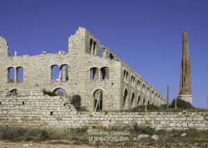
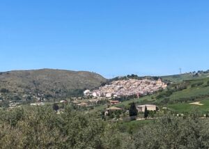
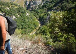
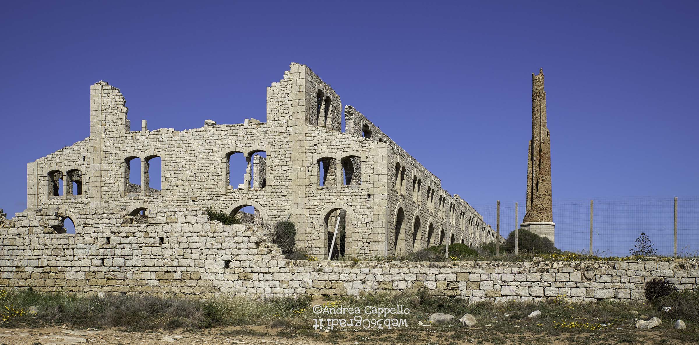
Cosa vedremo. L’Anello circumnaviga in senso antiorario un’area di notevole interesse ubicata nella porzione più elevata dell’altopiano posto a nord dell’abitato di Scicli. L’area contiene la “Casa Mormina” – abbandonata – e il laghetto posto ad ovest dei fabbricati, la Necropoli e le cave di pietra calcarea un tempo usata per le macine di tanti frantoi del sud Italia, il Pozzo del Giudeo, la chiesa di San Biagio, oggi sconsacrata e malamente riutilizzata da un soggetto privato.
Consente la vista delle Cave di Truncafila e di San Biagio, si connette con le piste ad est, per le miniere di pietra pece e l’Irminio, con quelle a nord, per i pozzi Irminio e per l’azienda agrituristica “Monsovile”, ad ovest con lo sterrato che con sensibile pendenza sale verso Scicli o scende anch’esso all’Irminio, attraversando la pista di “Pietrapalio”.
Al di là della SP 37 si connette poi con le stradelle secondarie asfaltate che portano a Donnalucata. Nel cuore dell’area circoscritta si vedono antichi oliveti (sul tratto asfaltato di accesso vi è infatti il Frantoio Fidone), carrubeti e seminativi che costituiscono il paesaggio agrario, insieme a fabbricati spesso semidiroccati, ma il più delle volte esempi di architetture rurali di un tempo che fu.
Scegliete le ore più fresche e non andate nei giorni immediatamente seguenti le piogge.
Dove trovare tracce, road book e info. Sul sito baroccoslowcoast.it
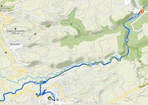
L’accesso al percorso è sulla SP 37 Scicli – Santa Croce. Al piazzale antistante l’Ospedale Busacca si pone lo zero del contachilometri e si segue la strada provinciale in agevole salita per 2,8 km, passando da 102 metri sul livello del mare a 219, con una pendenza media del 4%.
Coordinate utili.
Piazzale Ospedale Busacca: 36°47’38.09”N – 14°42’01.58”E Accesso itinerario: 36°47’51.42”N – 14°41’15.59”E
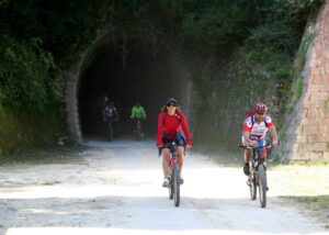
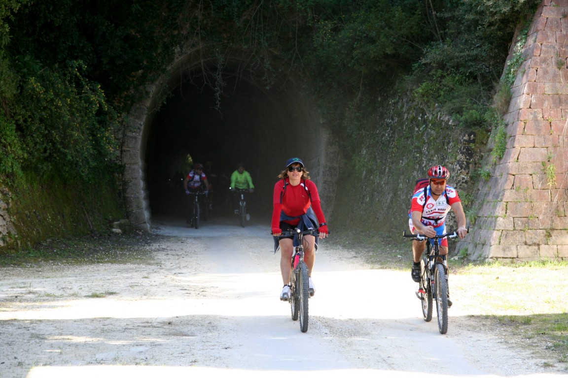
Come. Itinerario per mtbike o a piedi.
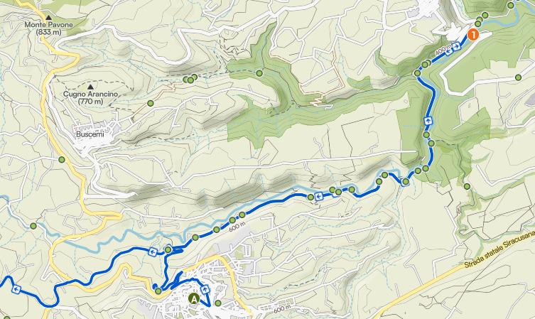
Il percorso (fra parentesi distanza progressiva e quota – sottolineati gli elementi descritti con schede aggiuntive e link). Giunti alla traversa della SP 37 che a destra porta alla contrada Giurdanella si azzera nuovamente il contachilometri e vi si accede, pedalando inizialmente in leggera salita. Dopo 2,2 km (253 mslm) pedalando sul sentiero ormai sterrato sulla destra si incontra la Cava San Biagio e al termine la pista perimetrale che scende verso la strada che porta all’Irminio e alle Miniere (2,55 – 238). Poco più avanti, sulla sinistra (2,70 – 256 e 2,90 – 264) due possibili accessi per le Case Mormina, raggiunte e superate le quali si incontrerà il laghetto. Torniamo sui nostri passi riprendendo la pista sterrata sempre in senso antiorario troveremo sulla sinistra una scivola dalla quale accediamo alla Necropoli (3,6 – 253), che i cui sepolcri si distribuiscono intorno ad un vecchio fabbricato semidiroccato. Al termine della visita, che colpirà anche i meno interessati e competenti, ci si dirigerà verso nord, passando per un ampio varco fra due aree contraddistinte da depositi costituiti da detriti calcarei di grosse dimensioni. In pochi sanno che esse rappresentano cave di estrazione di pietre che trasformate in macine per l’industria olearia furono reclamate in numerosi frantoi nelle regioni del mezzogiorno italiano. Puntiamo ora verso la trazzera delimitata dai due muretti a secco e se possibile vi pedaliamo dentro sin da subito, altrimenti dopo aver aggirato il piccolo fabbricato rurale in cattive condizioni. Al termine, una piccola divagazione a destra, per uno sguardo dall’alto del complesso degli scavi di Truncafila, poi si ritorna sulla pista principale per passare in mezzo ai fabbricati e dirigersi decisamente a sud. La strada improvvisamente torna asfaltata e – staccando il computerino della bici – compiremo una deviazione a sinistra (4,7 – 242) per incontrare, ancora a sinistra, il Pozzo del Giudeo, corredato di ingranaggi e canale pensile. Tornati sul percorso principale, dopo 50 metri faticheremo a riconoscere nel fabbricato sulla sinistra la chiesa di San Biagio, oggi sconsacrata e piuttosto malamente recuperata all’uso agricolo. Procediamo ora verso un primo bivio (4,95 – 238) e il secondo sarà con la SP 37 (5,4 – 233), sulla quale, svoltando a sinistra e pedalando perciò in direzione Scicli (sud est) incontriamo il punto di partenza dopo 6,25 km.
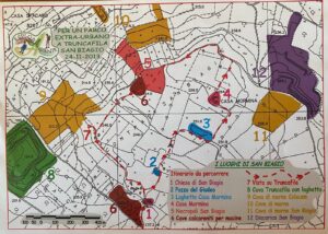
Mappa dell’Associazione Esplorambiente – Scicli
Map of the Esplorambiente Association – Scicli
The Necropolis Ring – among Byzantine tombs and other wonders
What we will see. The Ring circumnavigates counterclockwise an area of considerable interest located in the highest portion of the plateau located north of the town of Scicli. The area contains the “Casa Mormina”- abandoned-and the small lake located to the west of the buildings, the Necropolis and the limestone quarries once used for the millstones of many mills in southern Italy, the Well of the Jew, and the church of San Biagio, now deconsecrated and badly reused by a private entity.
It allows a view of the Truncafila and San Biagio Quarries, connects with the tracks to the east, to the pitchstone mines and the Irminio, with those to the north, to the Irminio wells and to the “Monsovile” agritourism farm, and to the west with the dirt road that with appreciable slope climbs toward Scicli or descends also to the Irminio, crossing the “Pietrapalio” track.
Beyond SP 37 it then connects with paved secondary roads leading to Donnalucata. In the heart of the circumscribed area you can see ancient olive groves (on the paved access stretch there is in fact the Fidone Oil Mill), carrub groves and arable land that make up the agrarian landscape, along with buildings that are often half-destroyed, but most often examples of rural architecture from a time long past.
Choose cooler hours and do not go in the days immediately following the rains.
Where to find tracks, road books and info. On the website baroccoslowcoast.it.
Access to the trail is on SP 37 Scicli – Santa Croce. At the square in front of the Busacca Hospital you set the odometer zero and follow the provincial road smoothly uphill for 2.8 km, going from 102 meters above sea level to 219, with an average gradient of 4 percent.
Useful coordinates.
Busacca Hospital Square: 36°47’38.09 “N – 14°42’01.58 “E Route access: 36°47’51.42 “N – 14°41’15.59 “E
How. Route for mtbike or walking.
The route (in brackets progressive distance and elevation – underlined described elements with additional tabs and links). When you reach the crossroad of SP 37 that leads to the Giurdanella district on the right, you reset the odometer again and enter it, pedaling initially slightly uphill. After 2.2 kilometers (253 mslm) pedaling on the now unpaved path on the right you meet the Cava San Biagio and at the end the perimeter track that descends to the road leading to the Irminio and the Mines (2.55 – 238). A little further on, on the left (2.70 – 256 and 2.90 – 264) two possible accesses to the Mormina Houses, reached and passed which will meet the small lake. We retrace our steps by resuming the dirt track, always in a counterclockwise direction, we will find on the left a slide from which we access the Necropolis (3.6 – 253), whose tombs are distributed around an old semi-destroyed building. At the end of the visit, which will strike even the least interested and knowledgeable, we will head north, passing through a wide gap between two areas marked by deposits consisting of large limestone debris. Few people know that these represent quarries for the extraction of stones that, transformed into millstones for the oil industry, were claimed in numerous oil mills in the regions of southern Italy. We now point toward the trazzera bordered by the two dry stone walls and if possible we pedal into it right away, otherwise after circumventing the small rural building in poor condition. At the end, a small digression to the right, for a glimpse from above of the Truncafila excavation complex, then back onto the main track to pass between the buildings and head decidedly south. The road suddenly becomes paved again, and – detaching the bike computer – we will make a detour to the left (4.7 – 242) to meet, still to the left, the Well of the Jew, equipped with gears and hanging canal. Back on the main path, after 50 meters we will struggle to recognize in the building on the left the church of San Biagio, now deconsecrated and rather badly recovered to agricultural use. We now proceed to a first fork (4.95 – 238) and the second will be with SP 37 (5.4 – 233), on which, turning left and pedaling therefore in the direction of Scicli (southeast) we meet the starting point after 6.25 km.

